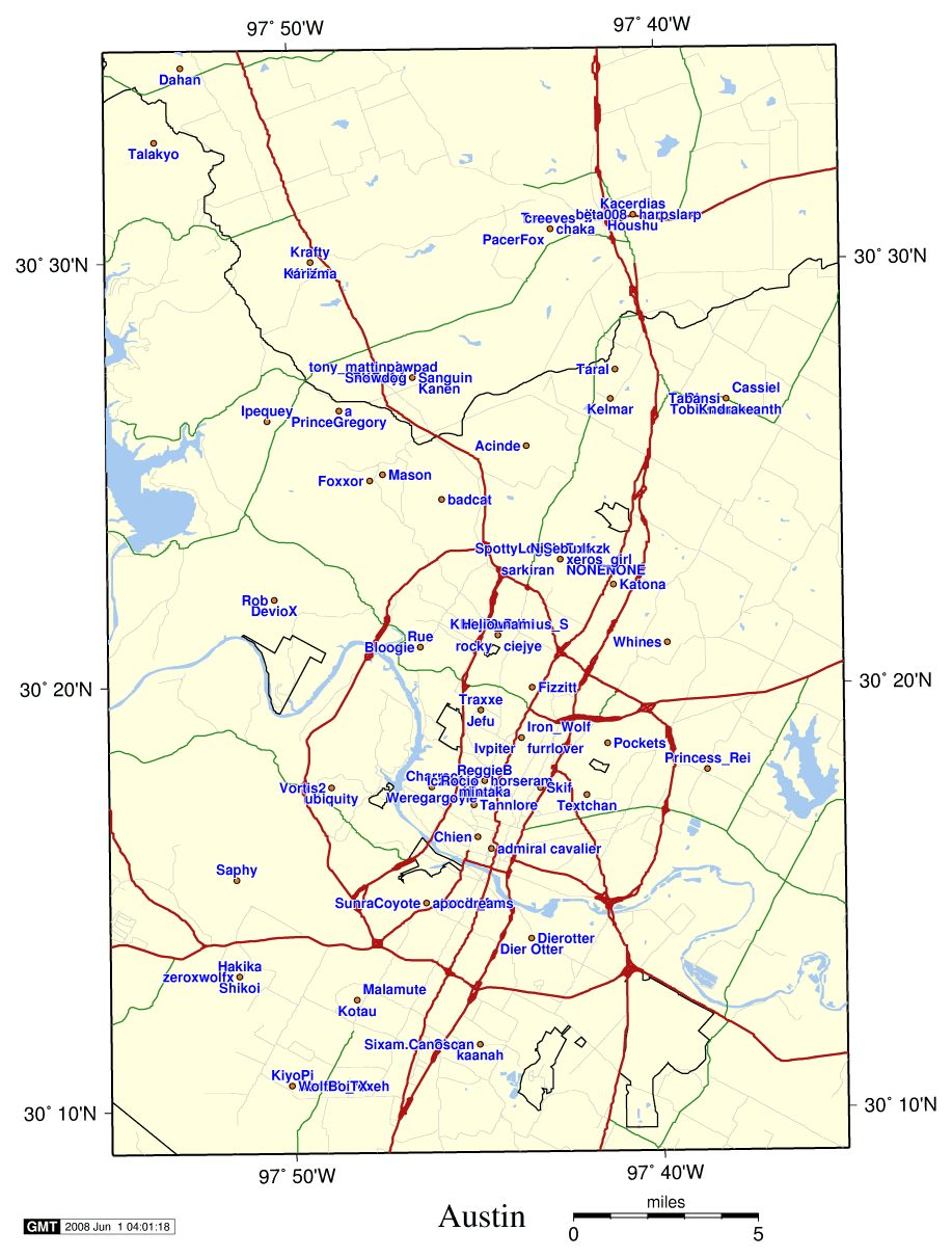
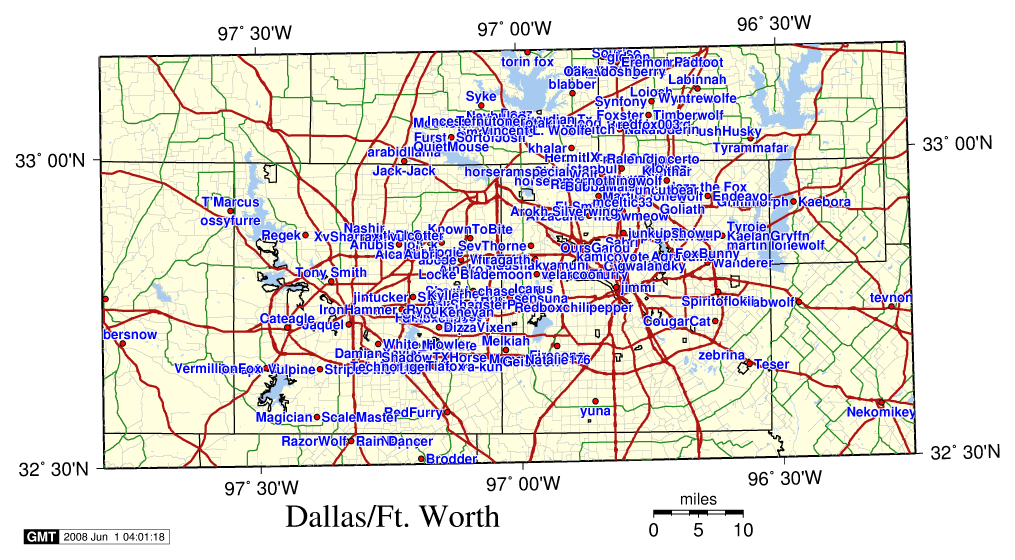
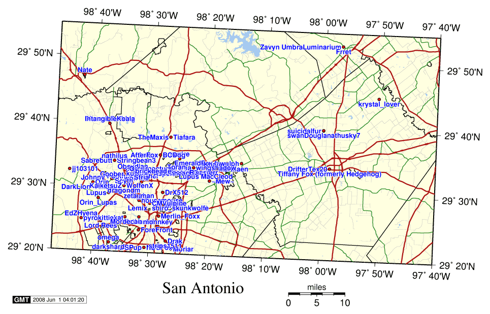
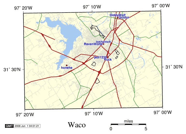
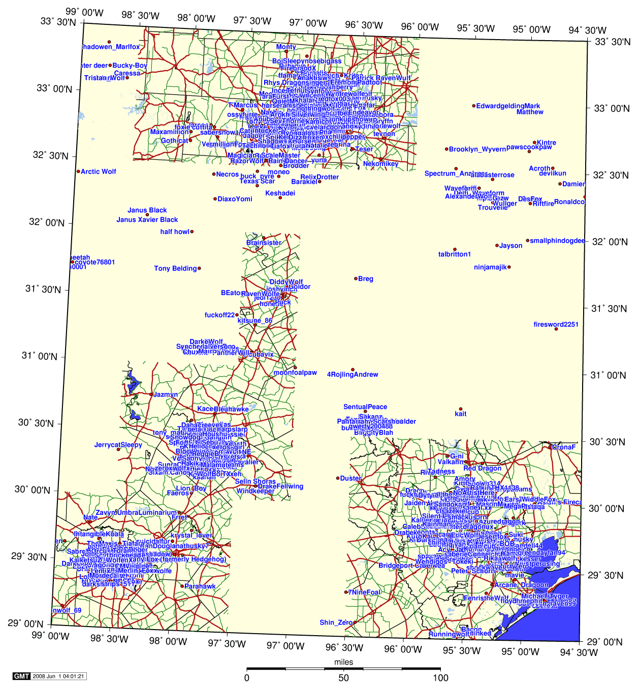
The Texas Furry Map
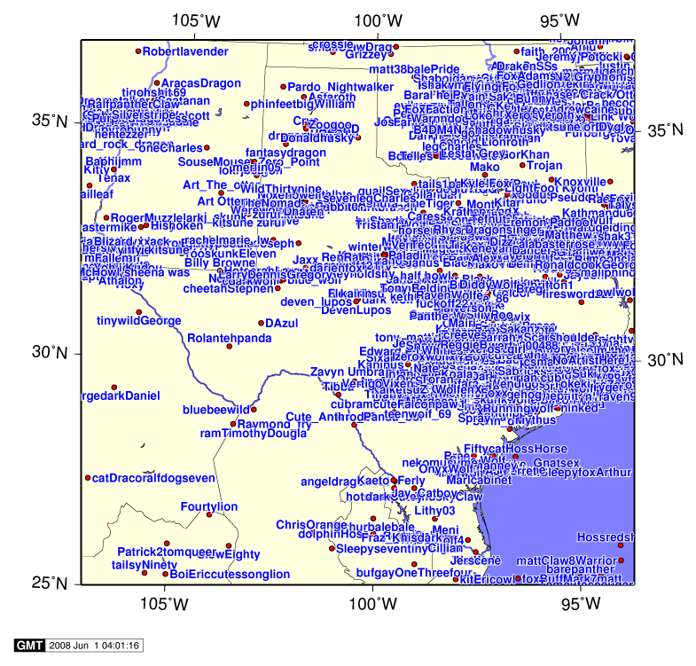
Here are a couple of maps showing where Texas furries are located, using data from the IFPL. The maps are drawn using GMT (The Generic Mapping Tools), which is a pretty nifty package :) The highway and road data come from USGS DLG files. Each file generally only covers 15 minutes of arc, so Houston took 108 files (48 for the county borders and 60 for the roads -- the downtown Houston road files only cover 7.5').
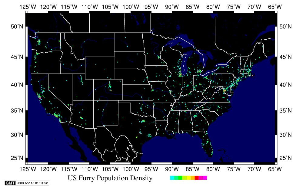
Well, it's not exactly Texas, but here's a map showing United States furs (population density)
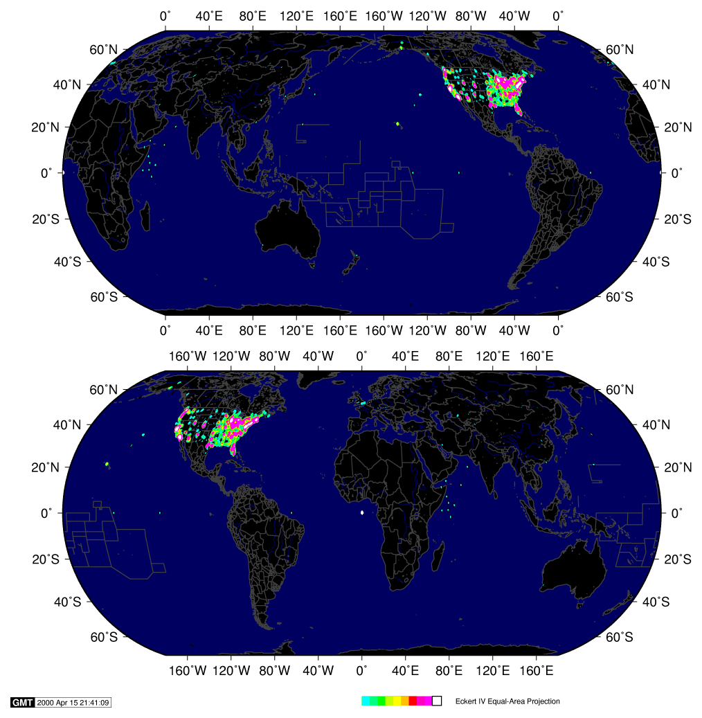
By popular request, the world! (population density)
All those poor furs floating in the middle of the ocean :) Remember,
western hemisphere is negative longitude, and southern hemisphere is negative
latitude.
Some statistics on how much stuff goes into these maps...
| IFPL data | 318K (that's everyone, not just Texas) |
| Austin roads | 3070K |
| DFW roads | 7620K |
| Houston roads | 7111K |
| San Antonio roads | 3421K |
| Waco roads | 3478K |
Data fetched from the IFPL at: June 1, 2008 04:00